AAC
The leading Ukrainian engineering company in the field of acquisition, processing and provision of geospatial dataWhy AAC
We offer high-quality geospatial data obtained by remote sensing of the earth.
Official information about AAC
All data is processed and interpreted in accordance with high standards of quality, accuracy and reliability.
We are aimed at continuous development and we are looking for new opportunities for international cooperation.
More detailsWe guarantee the fulfillment of our obligations under any circumstances
We provide a full cycle of production and its optimal organization
We have experience in various industries in many different developed and developing countries
Our specialists have a deep understanding of the composition and the relationships of geodata which makes it possible to effectively solve any task of the Customer
We are guided by the principle of "common sense" when performing work even if it is not stated within the contract, but required by the Customer
years of experience
countries
projects
customers
AAC is an expert in the field of collecting and processing geospatial data
AAC is the only company in Ukraine providing a full range of aerial services and other types of remote sensing of the earth's surface with further processing of the obtained data.
Applying a combination of various methods, we produce geospatial data of any complexity providing high performance.
More detailsProduct samples
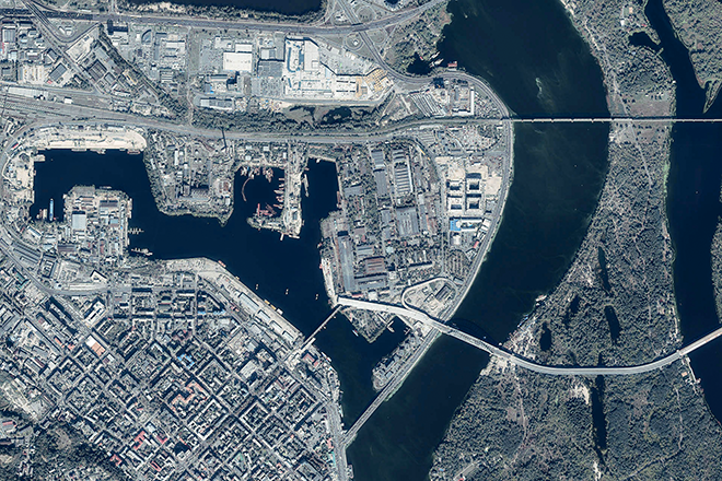


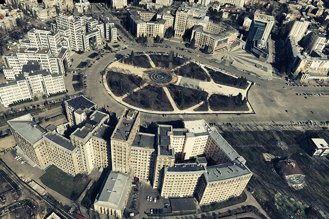


Technology

Aircrafts
The BeechCraft King Air C-90 aircraft is a light multipurpose aircraft equipped with two turboprop engines operated by PJSC Air Columbus. It is designed by the American company Hawker Beechcraft Corporation.
More details

Aerial equipment
AAC uses aerial sensors (aerialphotocameras, aviation laser scanners, thermal imaging sensors, etc.) which allow us to collect high-resolution data for the effective and efficient implementation of all your tasks.
More details

Photogrammetric and cartographic equipment
We use modern equipment and software at all stages of production which allow our specialists to process data and make photogrammetric and cartographic products of any complexity in the shortest possible time.
More details

Geodesic equipment
We use high-precision geodesic equipment to effectively receive field data that allows our specialists to solve engineering and geodesic tasks of any complexity.
More details

Museum of equipment and aircrafts
Our company has an experience in using various aerial, geodesic and other specialized equipment due to more than 20 years of experience in the industry.
More details
Project map
Working since 2000 AAC has an experience in implementing projects in various industries in Ukraine and abroad, which allows us to provide appropriate and complete satisfaction of the needs of each customer.
CONTACT US IF YOU HAVE ANY QUESTIONS
We are glad to assist you!